


Voting District 0456070000002, Eaton County, Michigan
About
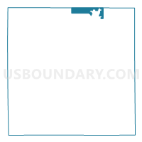
Outline

Summary
| Unique Area Identifier | 596393 |
| Name | Voting District 0456070000002 |
| County | Eaton County |
| State | Michigan |
| Area (square miles) | 5.37 |
| Land Area (square miles) | 5.27 |
| Water Area (square miles) | 0.10 |
| % of Land Area | 98.09 |
| % of Water Area | 1.91 |
| Latitude of the Internal Point | 42.76595930 |
| Longtitude of the Internal Point | -84.78879430 |
Maps

Graphs
Select a template below for downloading or customizing gragh for Voting District 0456070000002, Eaton County, Michigan


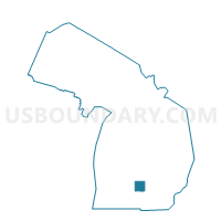
Neighbors
Neighoring Voting District (by Name) Neighboring Voting District on the Map
- Voting District 0372358000001, Clinton County, MI
- Voting District 0378440000001, Clinton County, MI
- Voting District 0452152000041, Eaton County, MI
- Voting District 0452152000042, Eaton County, MI
- Voting District 0452152000082, Eaton County, MI
- Voting District 0453342000001, Eaton County, MI
- Voting District 0453342000002, Eaton County, MI
- Voting District 0453342000003, Eaton County, MI
- Voting District 0453342000004, Eaton County, MI
- Voting District 0456070000001, Eaton County, MI
- Voting District 0457002000001, Eaton County, MI
- Voting District 0671972000001, Ionia County, MI
Top 10 Neighboring County Subdivision (by Population) Neighboring County Subdivision on the Map
- Delta charter township, Eaton County, MI (32,408)
- Grand Ledge city, Eaton County, MI (7,784)
- Watertown charter township, Clinton County, MI (4,836)
- Oneida charter township, Eaton County, MI (3,865)
- Danby township, Ionia County, MI (2,988)
- Eagle township, Clinton County, MI (2,671)
- Roxand township, Eaton County, MI (1,848)
- Grand Ledge city, Clinton County, MI (2)
Top 10 Neighboring Place (by Population) Neighboring Place on the Map
Top 10 Neighboring Unified School District (by Population) Neighboring Unified School District on the Map
Top 10 Neighboring State Legislative District Lower Chamber (by Population) Neighboring State Legislative District Lower Chamber on the Map
- State House District 93, MI (98,165)
- State House District 71, MI (97,665)
- State House District 87, MI (96,428)
Top 10 Neighboring State Legislative District Upper Chamber (by Population) Neighboring State Legislative District Upper Chamber on the Map
Top 10 Neighboring 111th Congressional District (by Population) Neighboring 111th Congressional District on the Map
- Congressional District 8, MI (707,572)
- Congressional District 3, MI (694,695)
- Congressional District 7, MI (676,899)
Top 10 Neighboring Census Tract (by Population) Neighboring Census Tract on the Map
- Census Tract 203.02, Eaton County, MI (6,149)
- Census Tract 315, Ionia County, MI (5,529)
- Census Tract 104, Clinton County, MI (5,038)
- Census Tract 103, Clinton County, MI (4,836)
- Census Tract 204.04, Eaton County, MI (4,236)
- Census Tract 205, Eaton County, MI (3,538)
- Census Tract 204.02, Eaton County, MI (2,873)
- Census Tract 204.03, Eaton County, MI (2,850)